
An Introduction to the Quiraing
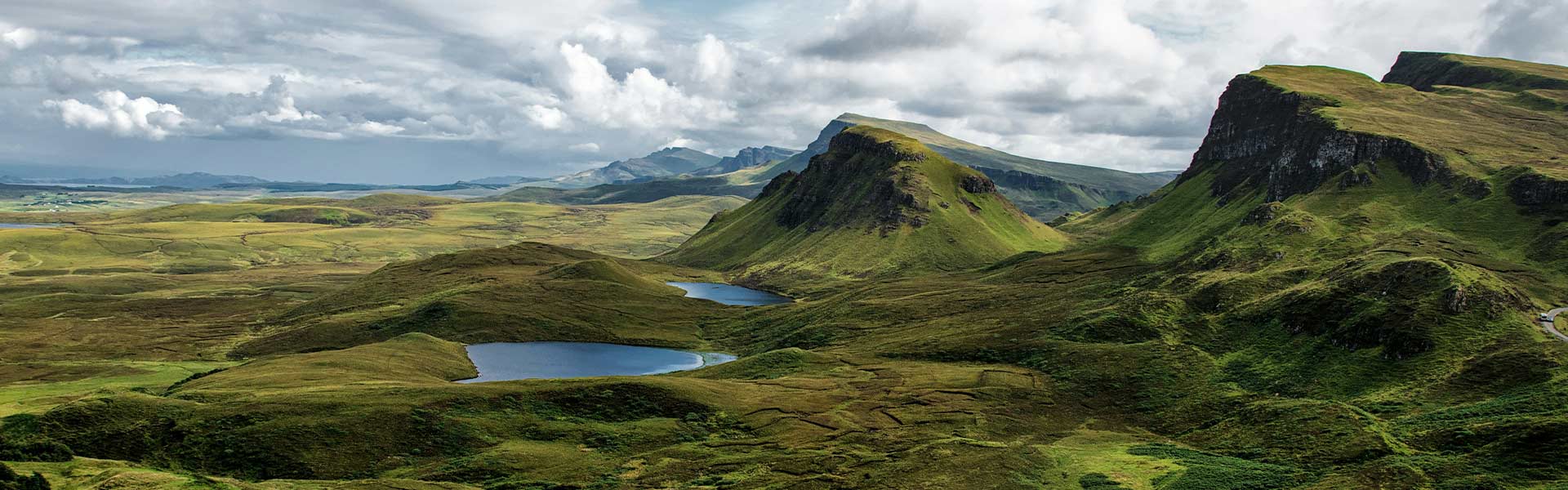
The Quiraing, located in the Trotternish area of the Isle of Skye, stands as one of Scotland’s most extraordinary landscapes. This ancient landslip has created a terrain that seems to belong more to fantasy than reality. With its towering cliffs, hidden plateaus, and pinnacles of rock, the Quiraing offers visitors an unforgettable experience regardless of the weather conditions.
For the physically able, hiking the Quiraing is an absolute must when visiting Skye. The otherworldly scenery and the sense of adventure make it a highlight of any trip to the Scottish Highlands.
Why is it called the Quiraing?
The name “Quiraing” comes from Old Norse, the language of the Vikings who once inhabited these lands. It’s believed to mean “Round Fold” – perhaps referring to the circular area surrounded by cliffs where people may have corralled their cattle.
What Makes It Special
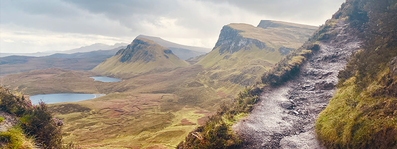
The Quiraing is part of the Trotternish Ridge, formed by massive ancient landslides. This process created a landscape of plateaus, hidden glens, and rock formations that seem to defy gravity. The area’s unique geology has made it a favourite location for filmmakers and photographers, appearing in numerous films and television shows. As you hike through the Quiraing, you’ll be walking through a landscape that tells a story spanning millions of years.
The Geological Formation of the Quiraing
The story of the Quiraing is one of ancient volcanoes, massive landslides, and the relentless force of glaciers – all happening over millions of years.
The Trotternish Ridge, which forms the backbone of the northern part of the Isle of Skye. This ridge began forming about 60 million years ago during a time of intense volcanic activity. Layer upon layer of lava flowed and cooled, creating a thick “plateau” of hard basalt rock.
Beneath this thick layer of basalt were softer sedimentary rocks like shale and limestone. Over time, the weight of the basalt caused these softer rocks to compress and deform. This led to a series of massive landslides along the eastern edge of the ridge.
Imagine entire sections of the cliff face, slowly sliding downhill. This process created the dramatic cliffs, pinnacles, and hidden plateaus that make the Quiraing so unique today.
The final touch to this landscape came during the Ice Age, which ended about 11,000 years ago. Massive glaciers covered much of Scotland, including Skye. As these glaciers moved, they carved and shaped the land, accentuating the features created by the landslides.
What’s fascinating is that this process of change isn’t over. The land is still slowly moving. In fact, the road at the base of the Quiraing has to be repaired regularly because of ongoing movement in the hills above.
The Quiraing Hike: What to Expect
- Distance: 6.8 km (4.2 miles) for the full circular route
- Starting Point: Car park at Quiraing (Grid Reference: NG440679, Apple Maps, Google Maps)
- Difficulty: Moderate to challenging
- Duration: 3-4 hours for the full circular route
- Ascent: 340 meters (1115 feet)
The Quiraing’s Rock Formations
As you walk through the Quiraing, you’ll see several interesting rock formations:
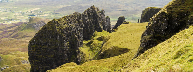
The Prison
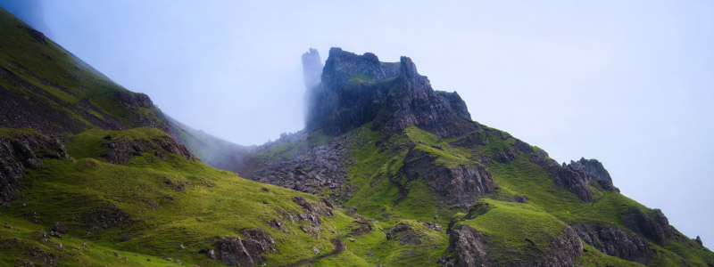
The Prison is a large rock formation that looks a bit like an old castle keep. It’s easy to spot and helps walkers find their way.
The Needle
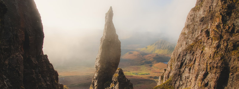
The Needle is a tall, thin rock that sticks up from the ground. It’s about 37 metres high and is a favourite spot for photographers.
The Table
The Table is a flat, grassy area hidden among the cliffs. It’s an unexpected sight in this rocky landscape and offers a great spot for a rest.
Quiraing Hiking Instructions
Important Safety Notes
- This hike involves narrow paths, steep slopes, and scrambling. Only attempt if you are physically fit and prepared.
- Weather conditions can change rapidly. Check forecasts and be prepared for all conditions.
- Bring appropriate gear: sturdy hiking boots, weatherproof clothing, food, water, and emergency supplies.
- Inform someone of your hiking plans before setting out.
- In case of emergency, call 999 or 112 and ask for Mountain Rescue.
Step-by-step instructions
- Park at Bealach Ollasgairte (NG440679).
- Locate the signposted path heading northwards from the parking area.
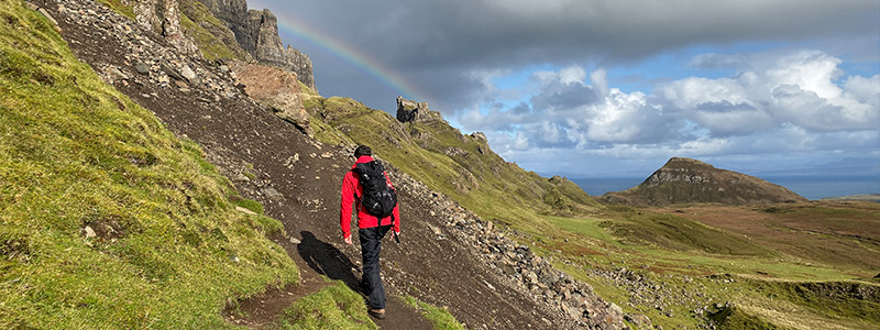
- Follow this path, which maintains a relatively level course along the hillside. Be vigilant for views throughout the walk.
- After approximately 1 mile (1.6 km), you’ll encounter a burn (stream) crossing. Exercise caution, especially if icy conditions are present.
- Continue until the path begins to steepen, climbing between two rock formations:
- To your right: “The Prison”
- To your left: The entrance to the Quiraing
- At the high point of the path, locate a cairn (rock pile marker).
- At the cairn, turn left, leaving the main path.
- Ascend the steep, earthy slope towards “The Needle” (a 40m high rock formation).
- Pass to the left of The Needle, continuing to climb.
- Locate a narrow path veering right, leading to a gap in the cliffs.
- Climb through this gully carefully. Be aware it may be slippery when wet.
- After emerging from the gully, you’ll be near the heart of the Quiraing. The path will initially descend slightly.
- Follow the path as it zig-zags up another steep rise towards “The Table” (a flat, grassy area).
- For easier access to The Table: a. Take the track to your left, passing in front of The Table. b. The track will turn right and rise gently to the top of The Table.
- To safely exit, retrace your steps back to the cairn by The Prison.
- From here, you have two options: a. Return directly to the starting point for the shorter route. b. For the longer circuit (including the summit):
- Turn left and follow the path along the base of the cliffs.
- After passing a small lochan (small lake), the path splits. Take the left fork.
- Continue following the cliffs until you reach Fir Bhreugach (NG448704).
- From Fir Bhreugach, turn back southwards along the top of the cliffs.
- You’ll pass above The Table, overlooking the Quiraing.
- The nearby summit of Meall na Suiramach is accessible for panoramic views.
- For the descent, keep well above and to the right of the clifftop.
- Locate the track heading southwest, descending steeply.
- This track will rejoin your outward route near the starting point.
Additional Safety Tips
- Stay on designated paths to protect the environment and ensure your safety.
- Be cautious of loose rocks and unstable terrain, especially in wet conditions.
- Maintain awareness of cliff edges throughout the hike.
- If visibility deteriorates, use a map and compass to navigate safely.
- Do not attempt to climb or access areas beyond your skill level.
Alternative Quiraing Routes
For those seeking a less strenuous option, you can enjoy some of the Quiraing’s scenery by walking the first 2 km of the path (to the cairn) and returning the same way. This gives a total walk of about 4 km with less elevation gain.
The Quiraing offers a hiking experience that will stay with you long after you’ve left the Isle of Skye. Its unique landscape challenges your perception of the natural world, while its paths test your physical abilities. Whether you’re witnessing the landscape shrouded in mist or bathed in sunlight, the Quiraing promises an adventure you won’t soon forget. However, always prioritize safety over reaching any particular point on the trail.
Practical Information For Visiting Quiraing
Best Time to Visit
You can walk the Quiraing all year round, but each season is different:
- Spring (April-May): The weather is milder and there are fewer people. Flowers start to bloom.
- Summer (June-August): This is when the days are longest, but it’s also the busiest time. Book your accommodation early if you’re visiting in summer.
- Autumn (September-October): The plants change colour, making the landscape very pretty. The weather can be unpredictable.
- Winter (November-March): The days are short and the weather can be very bad. Only try the walk in winter if you’re experienced and have the right equipment.
How to Get to the Quiraing
The Quiraing is on the Trotternish Peninsula of the Isle of Skye. The nearest villages are Staffin to the east and Uig to the west. For navigation, use postcode IV51 9LB.
- By Car: From Portree, take the A855 road north towards Staffin. The Quiraing car park is about a 30-minute drive from Portree.
- By Bus: The 57C bus from Portree to Uig stops at the Quiraing car park. Check the Stagecoach website for current timetables.

Parking Information
- The car park at the Quiraing is pay and display.
- Cost: £6
- Payment methods: Coins, cards, and mobile app options are available. If you’re paying for parking via mobile, enter the RingGo Parking Locator code 23484 to locate and pay for your parking space.
- Arrive early, especially in summer, as the car park can fill up quickly.
Facilities
- There are no toilets at the Quiraing car park or along the walk. The nearest public toilets are in Staffin or Uig.
- A food truck is often present in the car park, selling hot drinks, snacks, and sometimes hot food.
- There are no water refill points, so bring plenty of water with you.
- You may not have mobile/cell reception
Accessibility and Suitability
Is the Quiraing suitable for dogs?
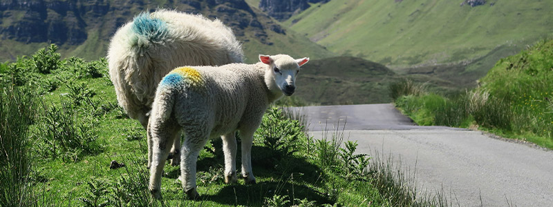
Dogs are allowed on the Quiraing walk, but they should be kept on a lead. There are steep drops and sometimes sheep in the area. The terrain can be challenging for dogs in some places.
Can children do the Quiraing walk?
The full Quiraing circuit is challenging and not suitable for young children. However, families with older children who are used to hiking might enjoy it. For families with younger children, walking the first part of the path (about 2 km to the cairn and back) can be a good option, although it should be noted their is a steep rolling drop immediately beside the path.
Is the Quiraing suitable for people with mobility issues?
The full Quiraing walk is not suitable for people with mobility issues due to its steep and uneven terrain. However, there are now two well-made paths near the car park that are suitable for those with mobility issues, one of which is almost flat an allow everyone to enjoy the view.
What to Wear and Bring
- Layered clothing: The weather can change quickly, so bring layers you can easily add or remove.
- Waterproof jacket and trousers: Even if the forecast is good, be prepared for rain.
- Sturdy hiking boots: Ankle support and good grip are essential.
- Hat and gloves: Useful even in summer, as it can be windy at the top.
- Backpack: To carry water, food, and extra layers.
- Map and compass: Don’t rely solely on your phone for navigation.
- First aid kit: Including any personal medications you might need.
- Sun protection: Sunscreen and sunglasses, even on cloudy days.
Photography Tips
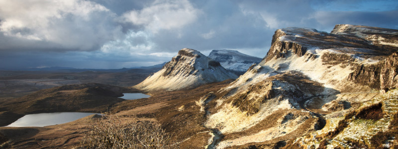
- Early morning sunrise off the best light for dramatic shadows on the landscape. If visiting solely for photography, consider visiting in the winter months.
- Bring a wide-angle lens to capture the expansive views.
- A polarizing filter can help reduce glare and enhance the colours of the landscape.
- Be prepared for changing light conditions as weather can shift quickly.
The Natural Environment
The Quiraing is a sensitive natural environment. To help preserve it:
- Stay on the marked paths to prevent erosion.
- Take all litter home with you, including biodegradable items like fruit peels.
- Don’t remove any plants or rocks.
- If you need to use the toilet, do so well away from water sources and bury any waste.
Nearby Attractions to the Quraing
If you’re visiting the Quiraing, you might also want to check out these nearby attractions:
- Old Man of Storr: Another iconic rock formation on the Trotternish Ridge.
- Kilt Rock and Mealt Falls: A scenic viewpoint with a waterfall plunging into the sea.
- Staffin Beach: Known for its dinosaur footprints.
- Duntulm Castle ruins: An atmospheric spot with great coastal views.